MAY 31, 2018 - CAPE CANAVERAL, Fla. (AP) — Despite a serious cooling problem, the newest U.S. weather satellite has produced a sharp snapshot of Earth.
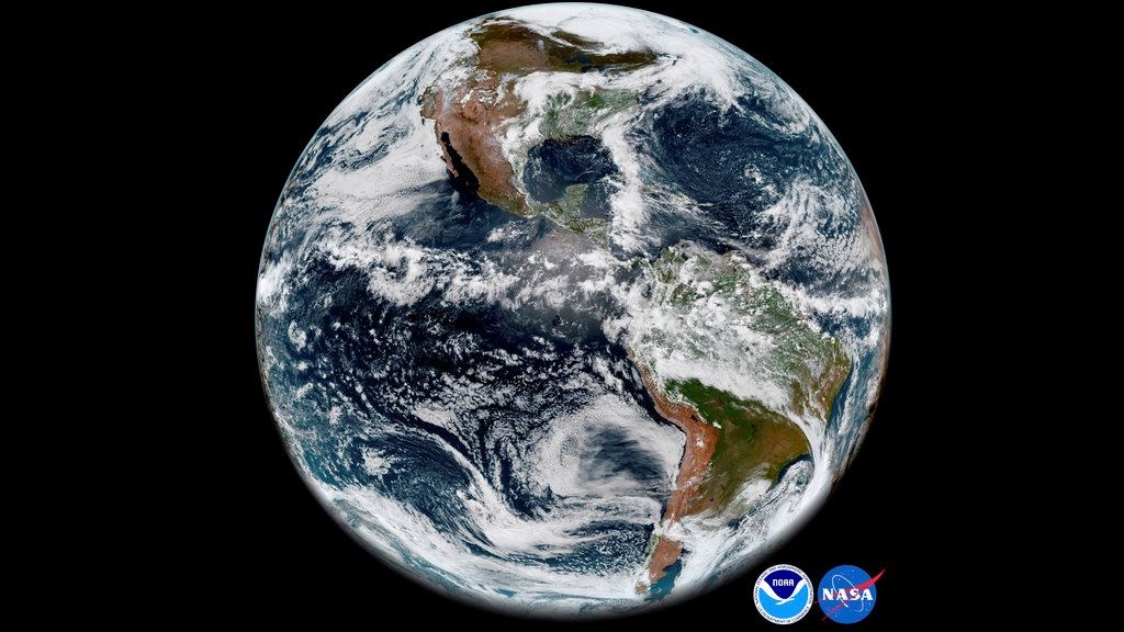 This image provided by NOAA/NASA on Thursday, May 31, 2018 shows the Earth’s western hemisphere at 12:00 p.m. EDT on May 20, 2018 made by the new GOES-17 satellite, using the Advanced Baseline Imager (ABI) instrument. The weather satellite observes Earth from about 22,300 miles above the surface. Despite a serious cooling problem, the newest U.S. weather satellite has produced sharp snapshot of Earth. On May 23, 2018, NOAA reported that critical infrared sensors in the satellite’s main instrument were not staying cold enough.NOAA/NASA via APThe National Oceanic and Atmospheric Administration released the GOES-17 satellite's first image Thursday. It shows the Western Hemisphere in detail from 22,000 miles up.
Last week, NOAA reported that critical infrared sensors in the satellite's main instrument were not staying cold enough. The picture taken May 20 and released Thursday relied mostly on the few unaffected channels in the visible light and near infrared.
NASA launched GOES-17 in March. The problem with the satellite's advanced imager cropped up during routine testing several weeks after liftoff. A special team is investigating the issue.
An identical imager, also made by the Florida-based Harris Corp., is working fine on the 2016-launched GOES-16.
Page created on 6/5/2018 9:27:13 PM
Last edited 6/5/2018 9:32:43 PM